The last adventure of this trip started in Price after visiting the CEU Dinosaur museum and all-you-can-eat Pizza Hut buffet.


I suggested we take a little bit longer, more scenic road home in Nine Mile Canyon. The name is very deceiving. It should be called the 80 (Nine) Mile Canyon. The road is paved and there are picnic spots and toilets along the way if you need them.

Here is the trip:
Leave Price going east on Highway 50-6 through Wellington. It is a total of 7.5 miles to the Nine-Mile Canyon turn-off (Soldier Creek Road). Turn left, or north to start your adventure.

26.2 first stop. There is a really tiny sign on the right hand side. You can see some pictographs & petroglyphs from the Ute and Fremont era on the left. (Looks like there is a prehistoric Bart Simpson head also.)
27.2 Cottonwood Glen Picnic area. There is an old cabin here built in the 1800's. The north side was added in the early 1900's. You can walk around and inside it.

You'll see a cute memorial (bench and stone) for a guy who apparently loved the Nine Mile Canyon and rock art. It's super sweet.

Go through the gate next to that and walk down the hill a bit to find a great picnic table next to the muddy creek.

31.9 Balanced Rock - The balanced rock is pretty obvious to find on the left side of the road. There is a petroglyph panel here.

Not on the balanced rock itself, but walk a little passed the rock and sign that says you are on camera nailed to a tree and there will be a another big rock wall.

(This is looking back at the rock where the petroglyphs can be seen.)
The panel is there. This is private property so you are supposed to just look from your car, but you will see a little worn path to go take a peek a little closer.

The road forks soon. The left fork goes up Cottonwood Canyon. Keep going straight (to the right) down Nine Mile.
38.8 Granary viewing. There are supposed to be remnants of prehistoric storage granaries around this spot. The front walls are supposed to be washed away so you can peek inside at floor, ceiling, and walls. We couldn't find this spot.
43.8 Daddy Canyon Complex - After you pass an industrial area on the right, there will be a parking lot on the left and toilets. Park here to get out and walk around.

There is a panel right at the beginning of the trail and then as you follow the loop you will see more elk hunt rock art.

If you go outside of the loop, there is a great spot for a small and pretty easy leisurely hike.

This is where I found my most favorite spot.

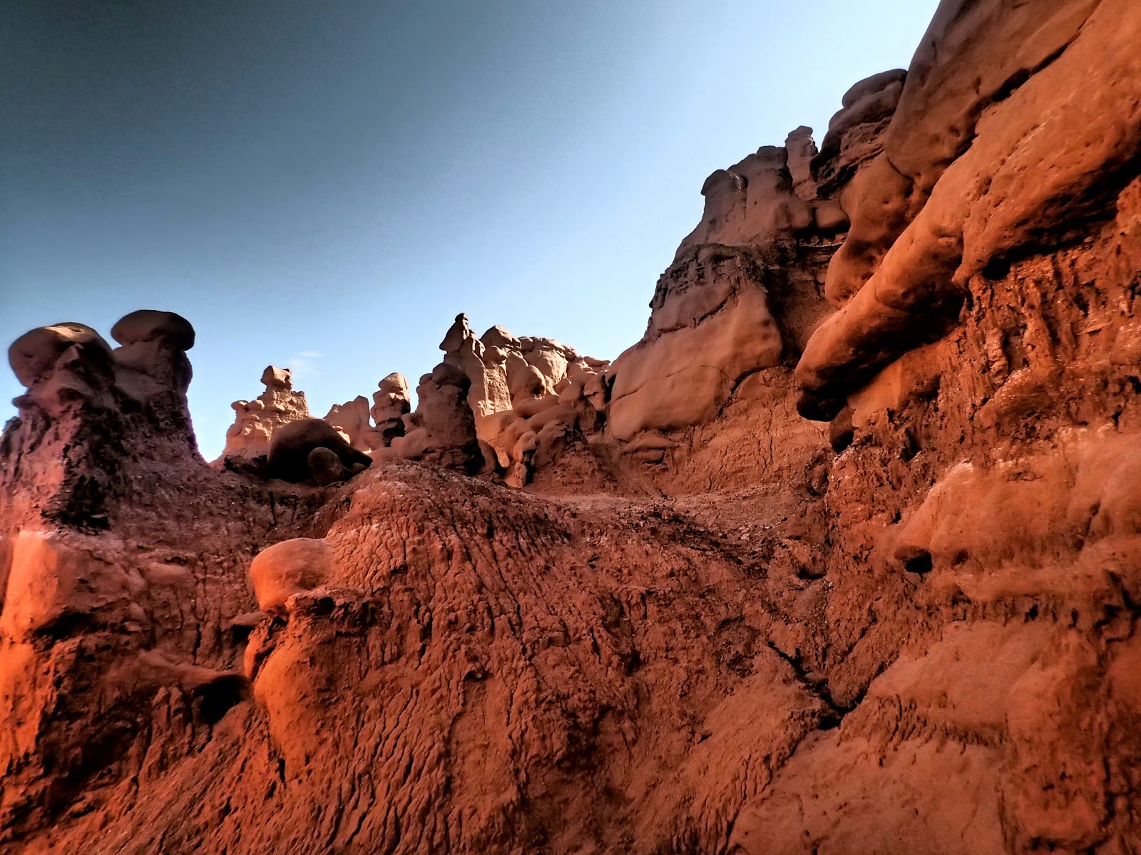
The colors of the rocks are magical.

This is as far as we went because the clouds were rolling in and we didn't want to participate in another flash flood. It also warns at the fork in the road that the road conditions can be impassible due to bad weather.
43.6 & 46 Gate Canyon. You can hike around in here if you desire. From the road, you will notice telegraph poles used to service the military post at Fort Duchesne.
45.5 Fremont Village. On the right hand side of the road, there is an unmarked trail up the hill that leads to remains of a Fremont era pit house. It isn't far at all. You will recognize it by the circle of stones.

If you keep going up the hill, you will find a cool rock hut/cave thing that you can walk through.

If you go even higher up, you will find a flat area with a cool giant rock sitting on top.


I don't know if this spot has any great significance, but there is a fantastic view and breeze if you are hot from hiking up.
45.9 Great Hunt Panel (You will see a small sign for the Big Buffalo site between these two, but I'd recommend going to the Great Hunt first and then turn around stop there just for easier parking). There is a big parking lot on the right side. Park and follow the path on the right for a very brief, flat walk.

This is one of the most recognizable petroglyph panels. It has been in National Geographic and numerous times to represent Fremont rock art. It is believed to be a bighorn sheep hunt in the Fall when herds gather for mating season.

This is the only spot that actually has a marked path and sign explaining the site.


Turn around and head back the way you came. Stop on the left 0.2 miles for the last spot.
45.7 Big Buffalo Site. Pull over on the left side of the road. Look for a worn path down into a small ditch and up for a super short, straight walk to the big rock wall you can see from the road. (You might be tired by now, but this stop will not disappoint you.)

Near the bottom of the big wall, you will see some rock art. Here is the largest buffalo petroglyph in the canyon.
After looking at these, head north on a trail to see the pregnant buffalo, other animals, human figures, and a date and signature of the person who found the pictures.

(If you are facing the large buffalo rock wall, turn left. There was a fence with barbwire that looks like you are not supposed to pass. I think it is to keep cattle out of the area.

Manage your way by it and walk like 1 minute farther through the bush. It's not far and the best spot here!
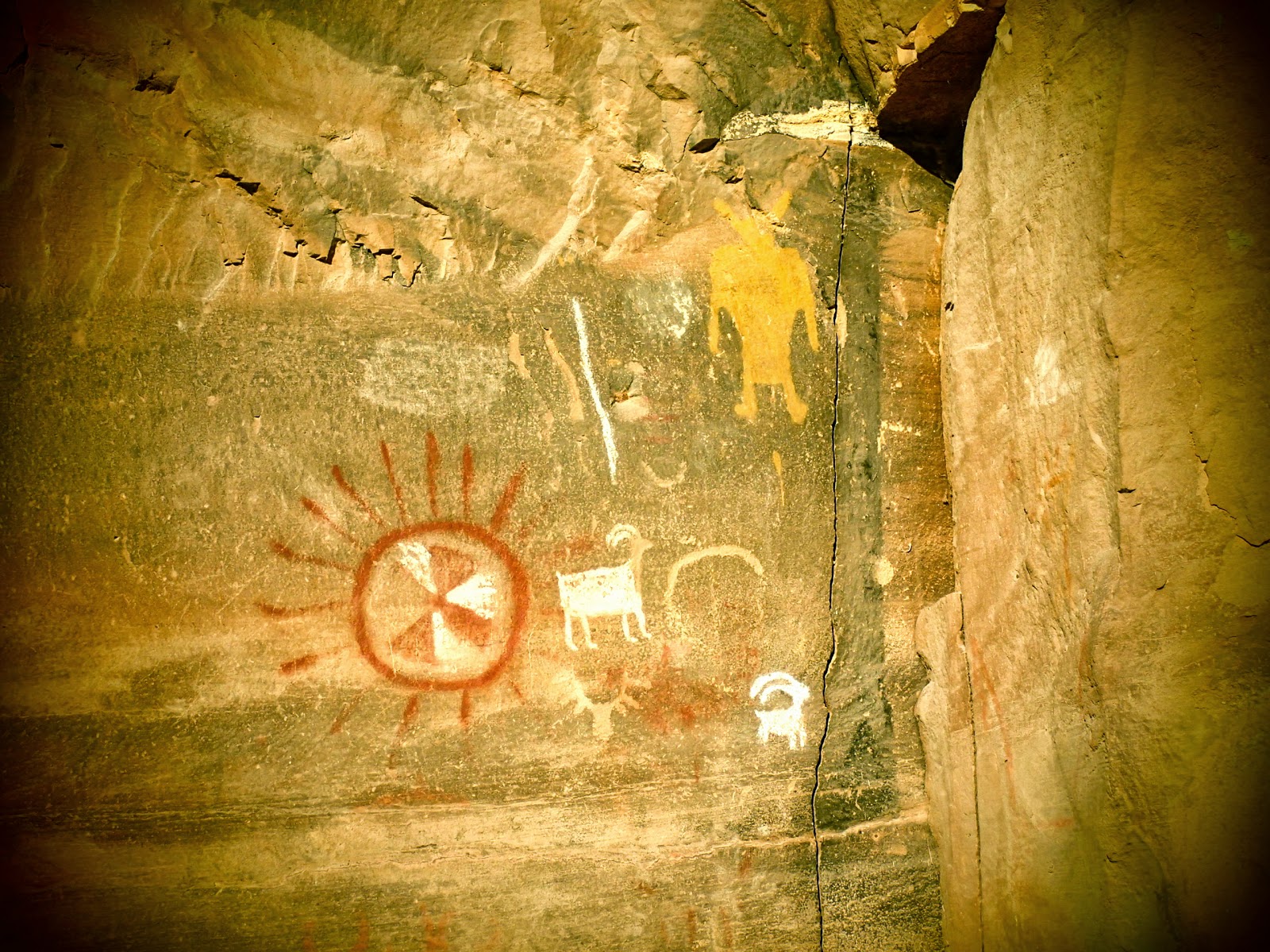

BONUS spot. As you are headed back down to the fork in the road, you will pass the Daddy Canyon Complex. Just after the parking lot, there is a small little U-shaped turn up to the rock where you can find a funny spot that we saw in a photo on display at the Dinosaur Museum.

At the fork in the road, you can choose to go back down the way you came or take the other road and head north up Cottonwood Canyon. WARNING: the pavement runs out after a few miles and is a really rocky dirt road for over at least 10 miles. This backcountry byway is a little rough if you are in a small car.


The pavement comes back and the road takes you by a million drilling machines and pipeline to Myton where you can turn right to head toward Duchesne.
The End.




 Posts
Posts


